Bazirana na analizi brodskih logova od 1700-1850 (dakle, uključena i prva polovica 19-tog stoljeća).
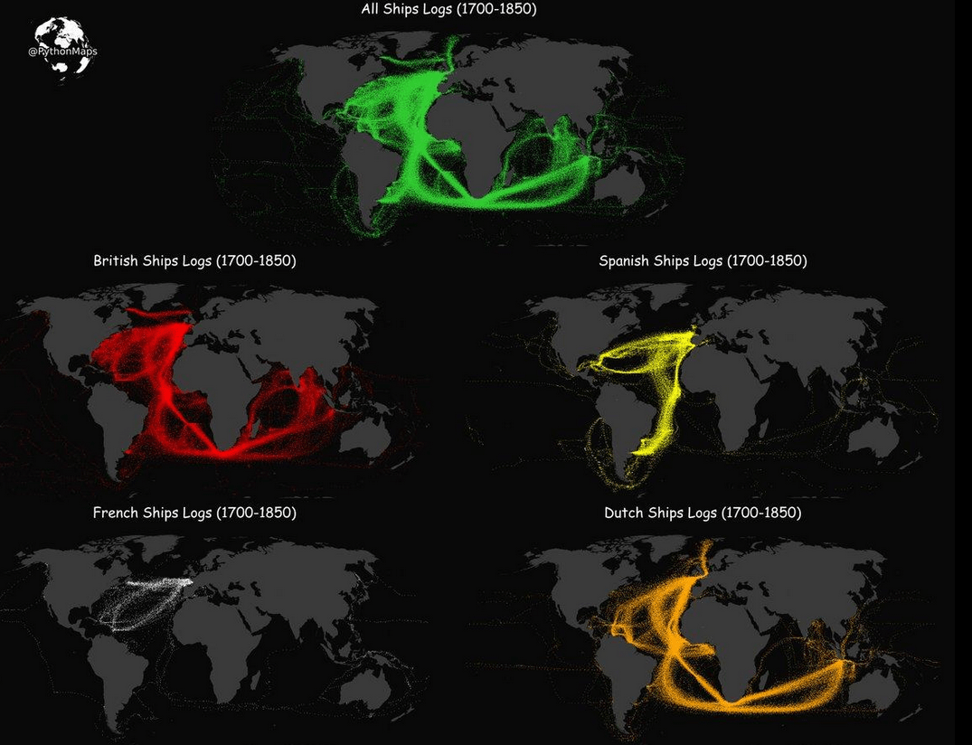
At the top, in green: shipping routes of various nationalities. Below: those nationalities shown in isolation. Red is for British ships, yellow for Spanish, white for French and orange for Dutch.
The British and Dutch rivalled each other both in terms of volume and geographic spread – roaming widely across the Atlantic and Indian Oceans.
The Spanish mainly kept to the Atlantic, crossing over to their possessions in the Americas. The French confined themselves to the North Atlantic, heading mainly towards the Caribbean.
Via Strange Maps ❤️.